12 July 2024
Updates to Rock Mass Data Analyser structure
There have been lots of recent changes to the Rock Mass Data Analyser. Some of these changes just add features, but as part of these changes we have had to re-organise how the data is structured in the app. This means that the individual databases for all of the data now come in as aliases in the root...
29 May 2024
Hazard Assessment – Event Rate
The Hazard Assessment application uses a grid-based approach to describe the seismic hazard throughout your mine. Each grid point essentially represents a seismic source with a specific frequency-magnitude relationship. A frequency-magnitude relationship is defined from the MUL, Mmin, b-value, and event...
21 May 2024
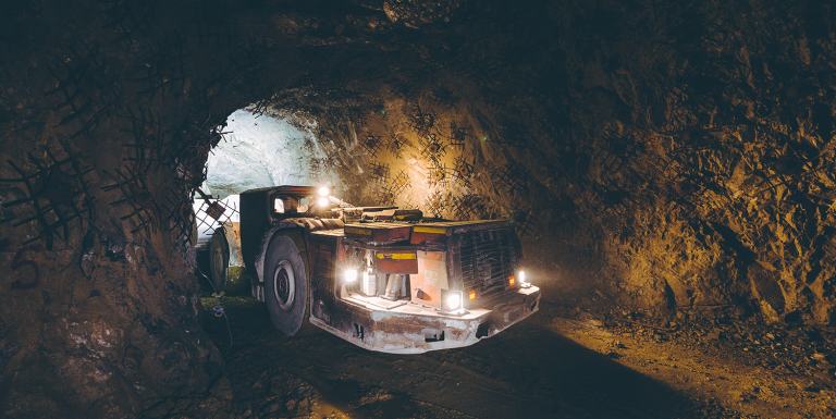
Inspections and data entry app
We are excited to announce our new inspections and data entry app. This app is a general purpose data entry app designed for offline use with tablet devices which can be customised to fit each site’s exact needs.The app allows simple and fast input of multiple data types (selection, text, numerical...
03 May 2024
Filter volumes library changes
We have recently updated the JavaScript library mxjs/base/algorithms/filter_volumeset.js to be more efficient. If you are using this library and call the flag_members() method of volume sets directly, then you will need to update your code slightly. If you don’t call flag_members() directly then...
03 April 2024
Export Panel for 3D Views, Charts and Tables
The export panel, located on the right-hand side of 3D views, charts and tables, can be used to generate images, files, and videos with just a couple of clicks.
This panel is particularly useful for preparing presentations and papers that require figures with specific dimensions...
07 March 2024
mXrap Version 6 – User Change Logs
We’re pleased to announce the release of mXrap version 6, bringing with it a range of enhancements to elevate your mXrap experience. This major update includes improvements to the user interface, as well as enhancements to speed when loading the root folder and applications. Additionally, we’ve...
22 February 2024
mXrap Version 6 - Developer Change Logs
mXrap version 5 will stop working in May.
We will be transitioning everyone to mXrap version 6 before then. As old root folders may not work in version 6 due to incompatibilities, all root folders and apps must be checked to ensure they work in version 6. To avoid any downtime for our users and developers,...
05 February 2024
Modifying The Blast Record
When trying to add, delete or change blasts in mXrap, best practice is to use the ‘Blasts Editor’ found under the ‘General Set-Up Windows’ tab:
If you need to make bulk changes however, it may be tempting to directly alter the input file in the root folder.
Problem: When you...
01 February 2024
Changes to root structure
There has been some rearrangement to the ! folder within the root folder, which may affect some of your apps. This was primarily a move of tools which are not seismic specific from the ! folder to !/Base (so that mines without the seismic suite can use these tools). The most commonly used parts of this...
01 November 2023
RMDA app: new geotechnical domains delimiter app and more!
A new app has appeared in the Rock Mass Data Analyser suite: the Geotechnical Domains Delimiter. This app allows you to create your own geotechnical domains; either from boundaries (e.g. lithological contacts or fault planes) or volumes (e.g. lithologies, domains, selection boxes).
Figure 1: Surveys...